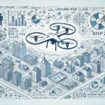
With the help of an up-to-date drone map, you can quickly and easily view no-fly zones and geo-zones and find out where you can fly your drone. We show you drone maps for various countries such as Germany and Austria.
An interactive drone map is ideal for quickly and easily checking which no-fly zones exist and where you are allowed to fly your drone. It is important to make sure that the map is up-to-date and contains official data.
In the following overview, we provide you with drone maps from various countries and explain what you should look out for when using the maps.
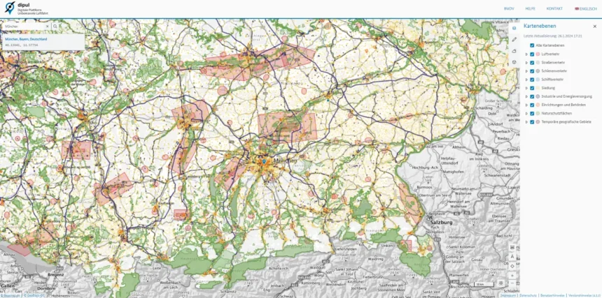
Drone map for Germany
- 👉🗺️ Where can I find the map?
- 🤔 How does the map work?
- The ministry provides helpful explanatory videos. They can be found on the official website. There are also detailed instructions in text form. The functions of the card and the terms are explained in detail there.
- 💡 What should I bear in mind?
- The EU Drone Regulation applies in Germany. You should therefore familiarise yourself with the necessary points of the regulation in order to understand all the important legal aspects of drone flying. Some important points apply, such as insurance and registration requirements.
Drone map for Austria
- 👉🗺️ Where can I find the map?
- To the official map of Austro Control.
- 🤔 How does the map work?
- You can find a comprehensive FAQ on how to use the Dronespace map on the official ACG website. There you will also find the download links for the new app so that you can conveniently prepare your flight while travelling.
- 💡 What should I bear in mind?
- The EU Drone Regulation applies in Austria. Therefore, familiarise yourself with the necessary points of the regulation to understand all the important legal aspects of drone flying. Some important points apply, such as insurance and registration requirements.
Drone map for Switzerland
- 👉🗺️ Where can I find the map?
- 🤔 How does the map work?
- The use of the drone map is explained on a separate help page.
- 💡 What should I bear in mind?
- Switzerland is not subject to EU regulations, which means that the EU Drone Regulation does not apply here. Switzerland defines its own drone laws. You should therefore familiarise yourself with the local rules.
Frequently asked questions and answers about drone maps
The map material for the maps we link to is usually supplied by the relevant national authority. This is to ensure that official and up-to-date data is used for the map material.
No, not necessarily. Even if you come across an open area without a geozone or flight restriction area, this does not automatically mean that you can simply fly there. There can be a variety of other reasons why a flight is not possible even in unmarked areas. For example, due to private property, safety distances to geo-zones, etc. You should therefore also familiarise yourself with the national drone laws.
No. The markings are not automatically to be understood as no-fly zones. The geo-zones, i.e. the colour-coded areas, indicate areas in which flying is permitted under certain conditions. These conditions are often very strict (hence the need for geo-zones), but are generally easy to understand. The national laws are responsible for this. The interactive drone maps usually show directly which paragraph applies here and which requirements must be met for drone flights.
Geozones, geo-zones or geographical UAS areas are areas defined by the respective member state in which drone flights are only permitted or completely prohibited with authorisation or under certain conditions. Outside of geo-zones, drone flights are generally permitted – unless an exception applies.


Bisher keine Antworten.
Lade neue Antworten
Nimm an der gesamten Diskussion im Drohnen Forum teil →