With the help of a new free tool, drone pilots can calculate the overlap of drone images in mapping projects. What you need it for and who it helps, we describe in this article.
The “Image Overlap Estimator Tool” allows drone pilots using DJI drones or Micasense systems to calculate the orthographic image coverage of a project before leaving the field. The tool was developed by Aerial Imaging Technology, a California-based aerial data acquisition and analysis company.
Necessary overlaps for drone footage
To create a high-resolution map or 3D model with a drone, it is important to collect consistently overlapping images. The greater the image overlap, the easier it is for modern image processing software to stitch the images together using repeated areas as reference. An overlap value of 70% or greater is considered sufficient for high-quality 3D model reconstruction with a visual sensor. For thermal imaging, a sidelap and frontlap of 80% is recommended.
Unfortunately, drone pilots often discover gaps or missing images in their dataset after they leave the scene. To solve this problem, Aerial Imaging Technology has developed a free tool that helps pilots calculate the overlap of drone images while still on location.
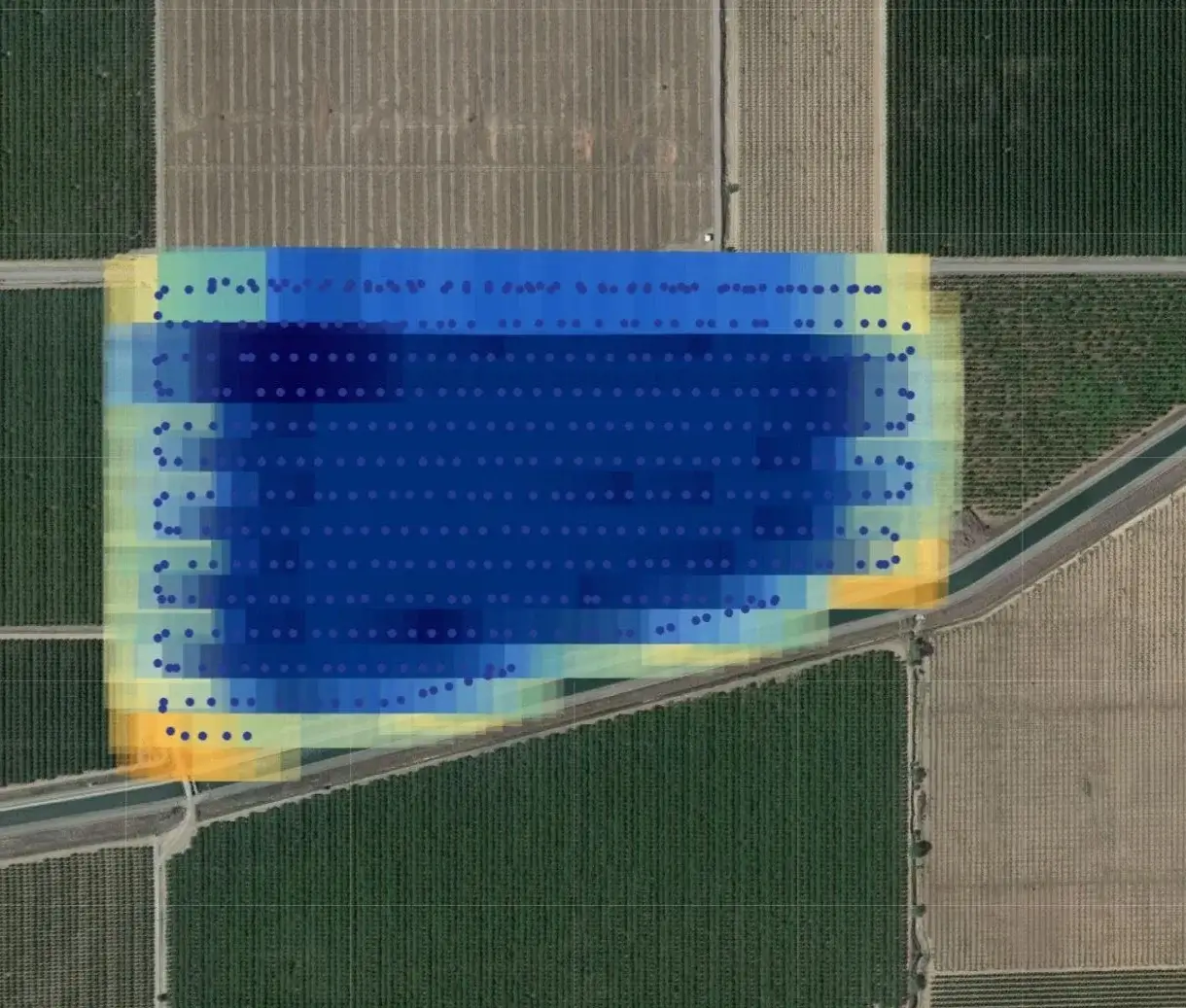
The tool is browser-based and can evaluate DJI or Micasense images and display their estimated locations and coverage areas on a map. This allows for easy and quick confirmation of data acquisition.
“We’ve developed a tool that allows drone pilots to confirm a project’s orthographic image coverage while still on site! This browser-based service takes DJI or Micasense imagery and projects their estimated locations and coverage areas onto a map. This allows for easy and quick confirmation of data coverage.” says the developers.
Calculation in places with poor Internet connection
However, what about locations with poor Internet connections – not uncommon in Germany and Austria. According to Aerial Imaging Technology, the tool does not “upload” images. Only the coordinates and metadata are uploaded, which should work well even with severely limited Internet services.
The free tool can be tried out here. Suggestions for improvement can be entered in the form at the bottom of the page so that they can be reviewed by the development team.
What is your experience with this tool? Or do you use alternative software that supports you in projects of this kind? Feel free to share your opinion on the topic.